


At this time, we are unable to fully guarantee the safety of our guests.
In addition, many of our guides are serving in the Armed Forces or supporting critical infrastructure.
We thank you for your understanding and look forward to welcoming you again after our victory.
Hutsul Alps:
Four Days in Marmarosh
Why this tour?
Grade


Days
Length
Accomodation

Dates available
184 €
Tour program
Day 1
Day 2
Day 3
Day 4
Price includes:
- bus transportation
- meals during the hike
- guiding services
Price does not include:
- equipment rent
- extra drinks and meals
- travel insurance
Special terms
The program of the tour is designed for physically healthy people who are interested in outdoor activities. The average distance of the daily walks is 16-18 km. Sections of rocky terrain may increase the complexity of the path. This tour is of moderate complexity and recommended to those who have the experience of day-long mountain walks. During the tour, everybody carries his/her own backpack with personal equipment and a share of food supply for the group.
Higher in the mountains, the temperature may be significantly lower than that at the foothills, and strong winds may occur. Unpredictable weather changes are possible, too.
The guide reserves the right to make changes in the program depending on the weather or the condition of the participants.
Recommended Equipment
- Passport as the walk route lies through the border zone, and tourists are obliged to register with the Border Guard. Tourists without passports will not be able to continue with the group.
- Backpack for hiking (40-50L for women, 50-70L for men) with a rain cover
- Tent
- Sleeping pad
- Sleeping bag (comfort rating 0..+5 Cº)
- Light trekking shoes and a spare pair (sandals or sneakers)
- Socks (1 pair per day, 1 spare pair)
- Thermal underwear (top, for spring or autumn season also bottom)
- Light pants (long, not shorts!), for spring or autumn season wind stop pants
- Fleece jacket or sweater, two for spring or autumn season (1 light and 1 warm)
- Light hat (cap, buff or bucket hat); warm hat for spring or autumn season
- Light wind stop gloves (for spring/autumn)
- Waterproof and wind stop jacket
- Raincoat (poncho)
- Sitting mat with a fixing belt
- Plastic bottle of water (1,5 L or more); a thermos for spring or autumn season
- Individual dinner set (spoon or spork, mug, pot, knife)
- Headlamp
- Cellphone
- Trekking poles
- Personal portable first-aid kit and toiletry
- Sunglasses
- Sunscreen
- Set of clothes for transfers during the tour (shoes, socks, underwear, outerwear): please mind that the clothes after hiking may be wet or dirty
Highlights
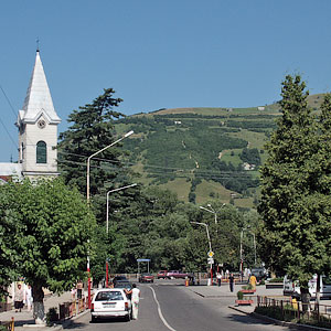 Rakhiv is a self-proclaimed capital of the Hutsuls and shepherds of Zakarpattya. It is the highest mountainous city in Ukraine: the elevation of the streets changes from 400 m asl to 1200 m asl. The town is located in the picturesque valley along the Tysa River. The first documented mention goes back to 1447. By that time, it already had its own seal and coat of arms and belonged to the Hungarian kings. One of the legends says that the name of the town derives from the word ‘to count’ since the city emerged on the intersection of trade routes, and merchants, who stayed here, were transferring money. Not far from Rakhiv, in the Butyn Ravine, one of the hypothetical geographical centers of Europe is located.
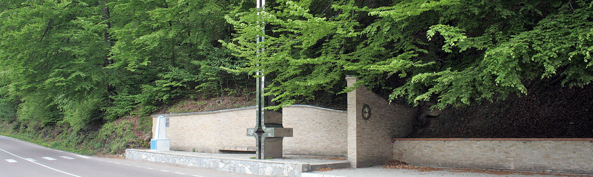
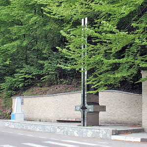 The Center of Europe is a geodetic mark, established in 1887 by the Austrian-Hungarian engineers on the territory, which belonged to the Austrian-Hungarian Empire at the time. On a two-meter stone column, there is a commemoration in Latin: «It is a permanent, exact, eternal place. The center of Europe was established with high precision on a scale of meridians and parallels, using a special device made in Austria-Hungary. 1887».
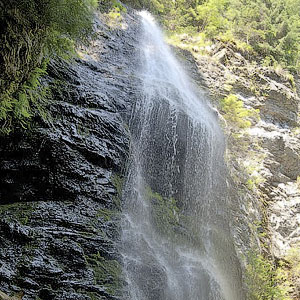 Yalynsky Waterfallis the highest single-cascade Carpathian waterfall, 26 meters high. Located within the Marmarosh mountain range, it emerged in a place where the water of the Yalyn stream, the right tributary of the White River, falls from a high vertical rock.
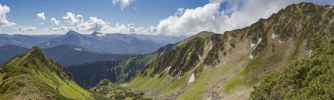
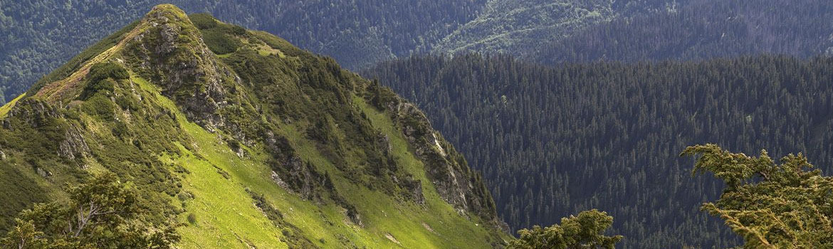
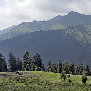 Marmarosh Range is a mountain group in the Eastern Carpathians. Its geological structure, and therefore landscape, is quite different from the other parts of the Ukrainian Carpathians. Its characteristic features are drastic height drops, deep valleys, rocky and steep cliffs; hence ‘Hutsul Alps’, the touristic nickname of Marmarosh. The most part of the Marmarosh Range is located in Romania and is called Maramureș in Romanian; its northern and north-western fringes, namely Chyvchyn and Rakhiv mountains, stretch to the Ukrainian territory. The part of the Ukrainian-Romanian border runs through the Marmarosh Range. The main peaks in the Ukrainian part of the Marmarosh Range are Pip Ivan of Marmarosh (1936 m asl), Neniska Mala (1820 m asl), Stig (1653 m asl), and Chyvchyn (1769 m). The area has extremely rich and diverse vegetation, with many rare and protected species.
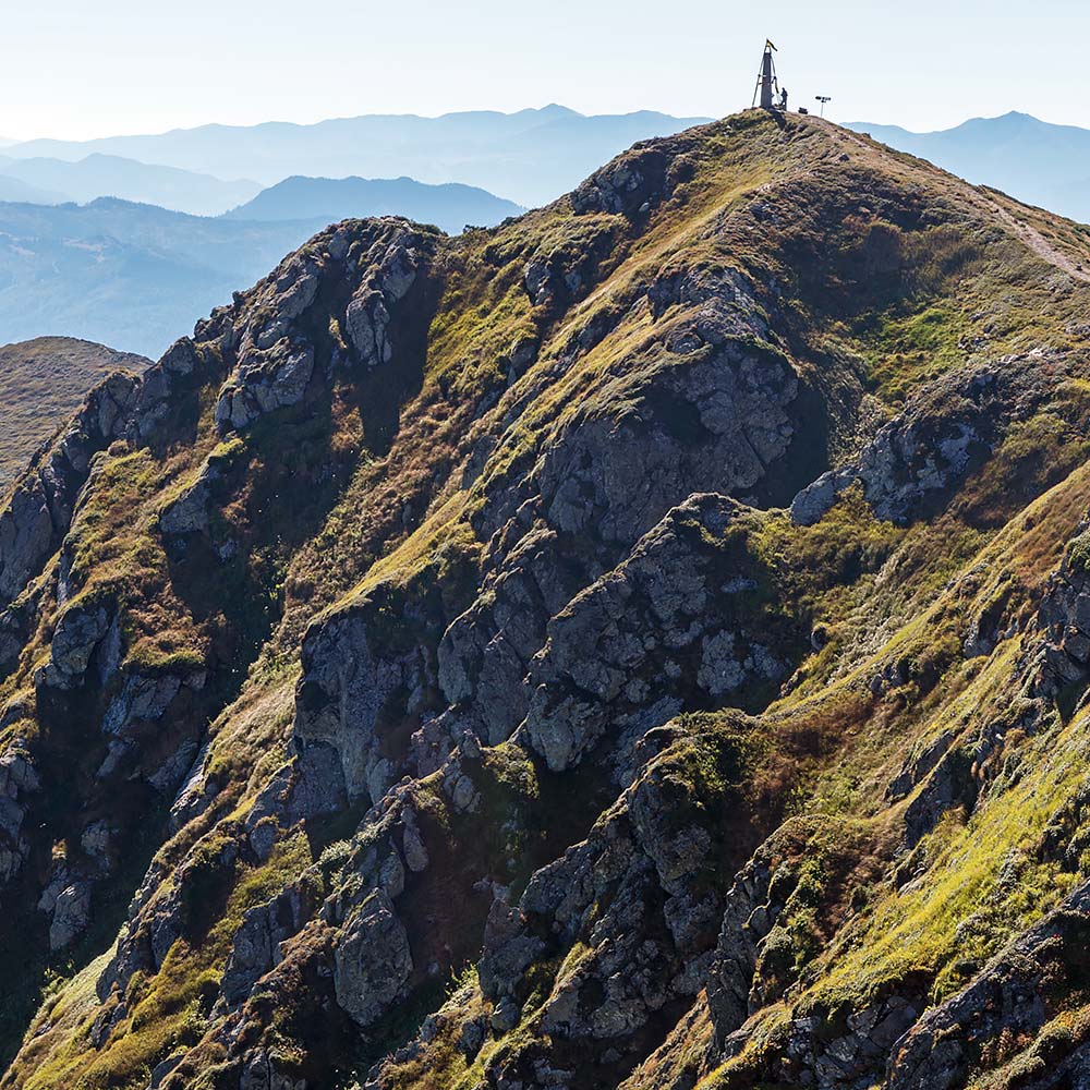
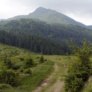 Pip Ivan of Marmarosh, 1936 m asl, is the highest mountain of the Ukrainian part of the Marmarosh Range. From its top, you can clearly see the Romanian side of the range, in particular, the peaks of Farcău and Mihailecu, well-known among trekkers. The summit of Pip Ivan of Marmarosh is pyramid-shaped, its northern and eastern slopes are very steep. Around the mountains, small lakes might emerge seasonally. There are many meadows and rare plants on this mountain. Take note that there is a namesake mountain in the Chornohora Range, Pip Ivan of Chornohora (2028 m asl), which is also a very popular Carpathian touristic destination as one of the Ukrainian highest mountains among the so-called ‘two-thounsanders’.
 Petros of Marmarosh (other names Petrosul, Pietros; height 1780.9 m asl) is the mountain in the so-called Rakhiv mountains, which are a part of the Marmarosh Range. There are two other mountains named ‘Petros’ in the Carpathians, in Gorgany and Chornogora ranges. Petros of Marmarosh has sharp peak and foothills and slopes covered with forests and meadows. The slopes are very steep, with deep rocky gorges.
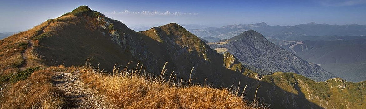
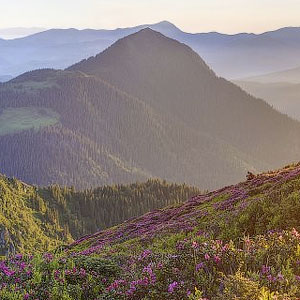
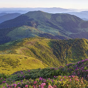 Berlybashka (1734 m asl). Local people also call this top ‘Latundur’. Hikers can enjoy magnificent vistas here: in a clear weather, many peaks are comfortably visible, including Polonyna Krasna, Apetska, Svydovets Range, Chornohora Range, Chyvchyn and Romanian Mountains.
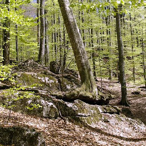 Marmarosh Nature Reserve is a part of the Carpathian Biosphere Reserve, which has a long history. Back in 1912-1914, the first Carpathian territories were protected, among them fir-tree forests in the upper Uzh River and spruce forests on the slopes of Pip Ivan of Marmarosh. These virgin forests became the main part of the Carpathian State Reserve in 1968, which later became the Carpathian Biosphere Reserve. Since 2011, some of its territories were designated as a part of the UNESCO world heritage site known as "Primeval Beech Forests of the Carpathians and Other Regions of Europe". It is the only UNESCO Nature World Heritage site in Ukraine. Virgin beech forests of the Carpathians are crucial for the understanding of the complex history and evolution of the beech species due to its prevalence in the northern hemisphere.
Accommodation
Meals
2-3 day: cooked camp food for breakfast and dinner, snacks for lunch
4 day: cooked camp food for breakfast, snacks for lunch, dinner in the restaurant
Rules
- No alcohol during the active walking part of the tour
- Please stick to the tour schedule and do keep up with the group
- Do not litter and take your waste with you
- Children under 16 should be accompanied by adults
Language
Additional information:
- transfer from the railway station or airport
- booking accommodation in hotels
- guided tours
- advice regarding your stay and leisure time in Lviv — don’t hesitate to ask!
Video:
Відгуки:

Navigation
2026 © All Rights Reserved.