


At this time, we are unable to fully guarantee the safety of our guests.
In addition, many of our guides are serving in the Armed Forces or supporting critical infrastructure.
We thank you for your understanding and look forward to welcoming you again after our victory.
Ascending Hoverla and Khomyak
Why this tour?
2 days
141 €
on request
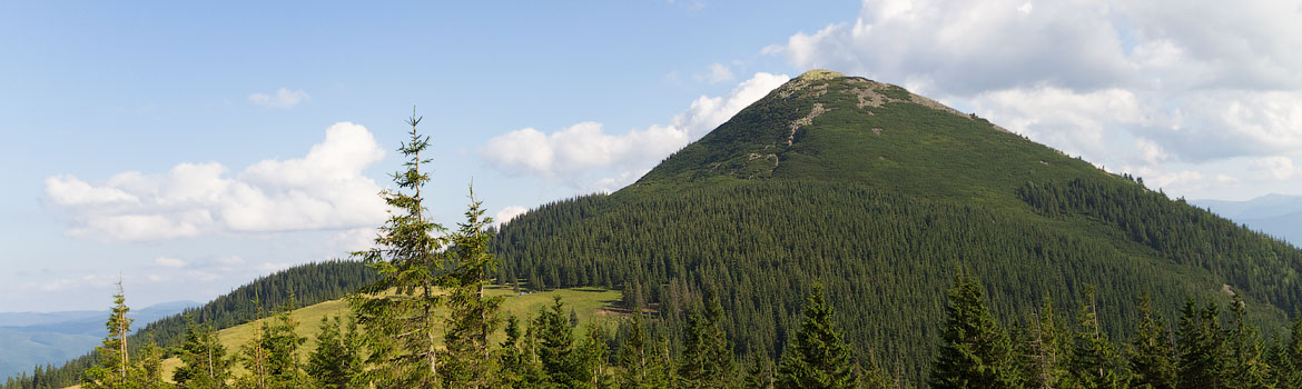
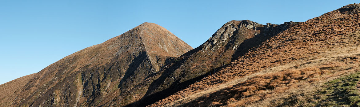
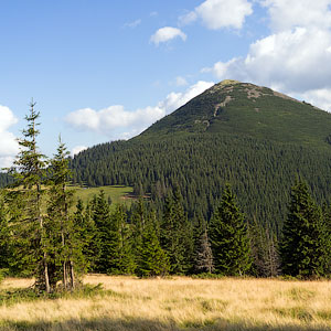
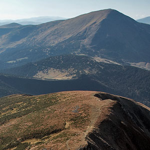
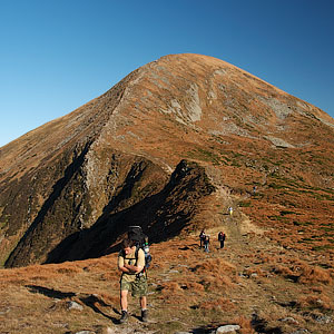
Khomyak Mountain
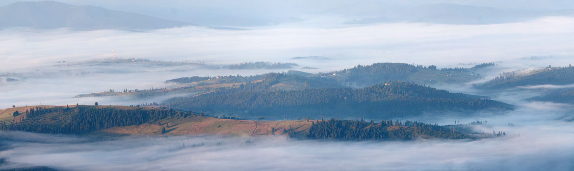
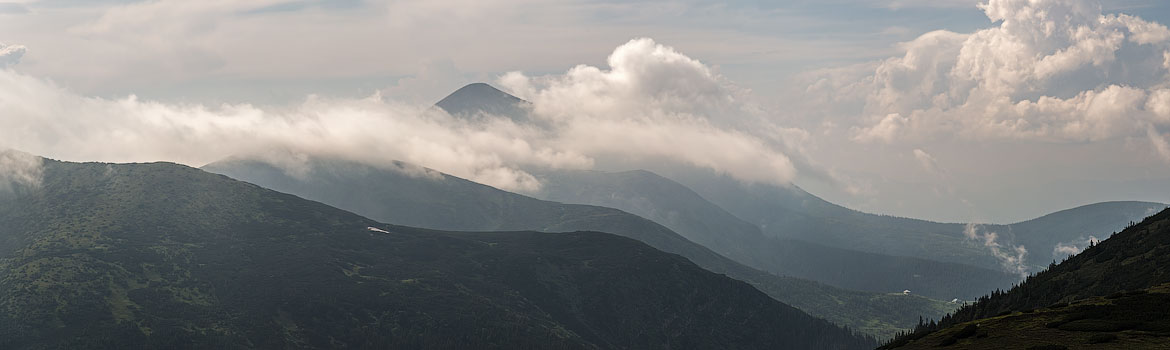
Vistas seen from the Khomyak summit
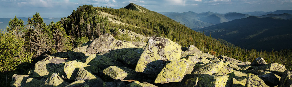
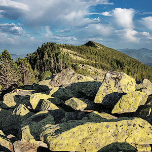
Stone fields in Gorgany
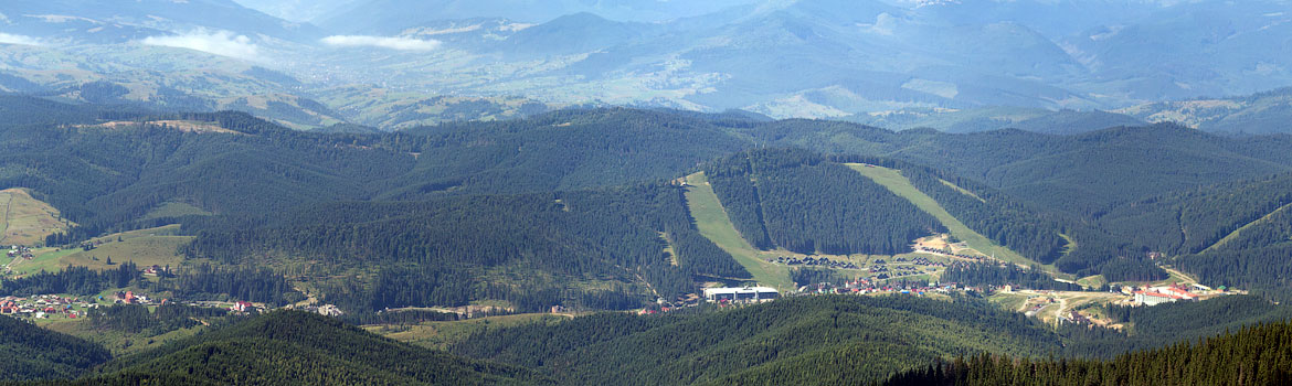
Vistas seen from the Khomyak summit
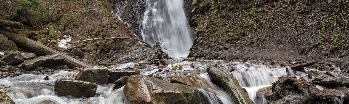
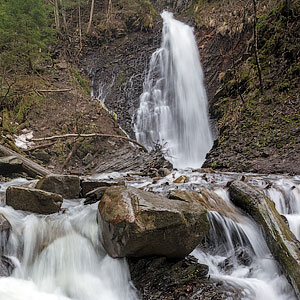
Zhenetsky Waterfall
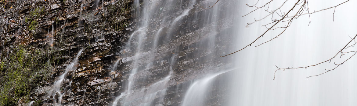
Zhenetsky Waterfall
Hoverla Mountain
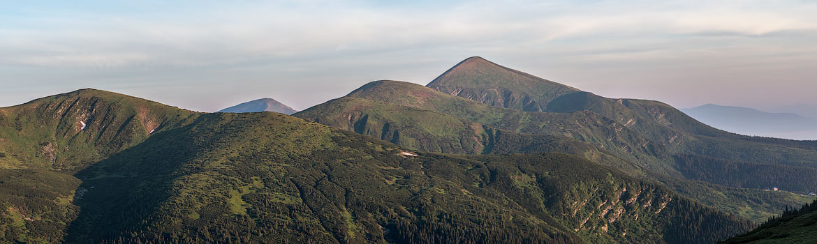
Chornohora Range and Hoverla Mountain
Hoverla Mountain
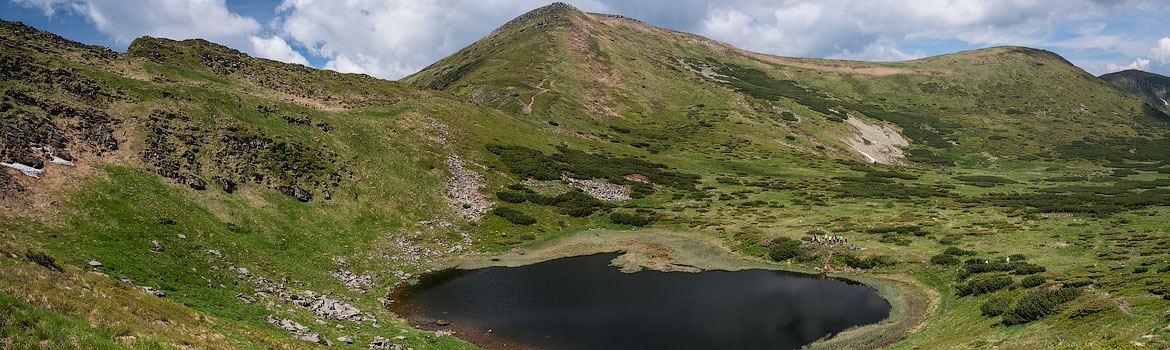
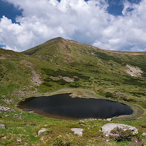
Lake Nesamovyte
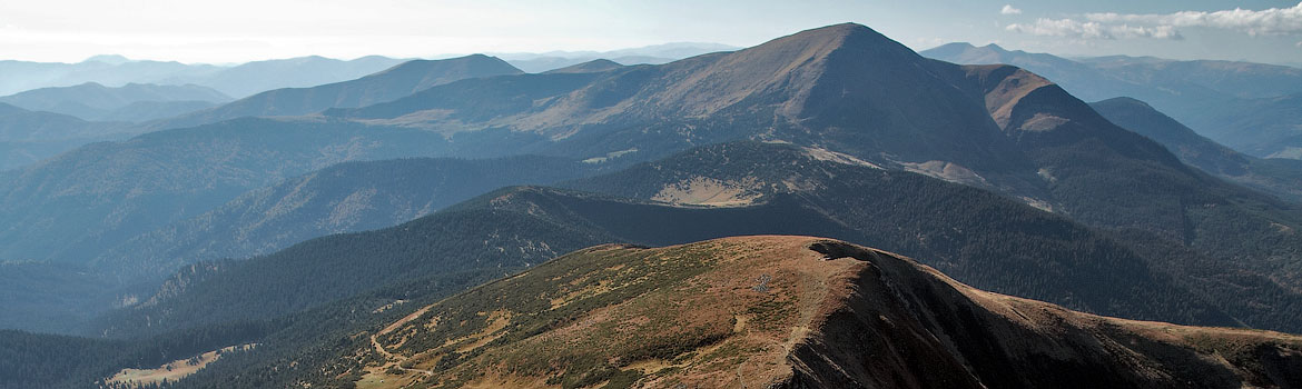
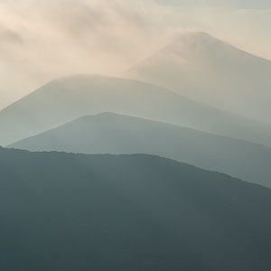
Petros Mountain, viewed from Hoverla
Tour description
day 1
- departure from Lviv (7:00)
- transfer to Tatariv village
- walk to Khomyak Mountain through Homyak Meadow
- snack break
- ascent to the summit of Khomyak Mountain
- descent to Zhenetsky Waterfall
- transfer to a lodge and check-in
- dinner
day 2
- breakfast in the lodge
- check-out
- transfer to Zaroslyak tourist camp
- ascent to Lake Nesamovyte
- snack break
- ascent to the summit of Hoverla Mountain
- snack break
- descent from Hoverla Mountain
- return to Lviv (appr. 22:00)
Price includes:
- bus transportation
- meals during the hike
- overnight stay and meals in a lodge (dinner and breakfast)
- guiding services
Price does not include:
- equipment rent
- extra drinks and meals
- travel insurance
Special Terms
The program of the tour is designed for physically healthy people who are interested in outdoor activities. The average distance of the daily walks is 8-15 km. Sections of rocky terrain or sometimes with snow may increase the complexity of the path. The tour is of low level of complexity and recommended to those who have the experience of day-long mountain walks. During the tour, everybody carries his/her own backpack with personal equipment and a share of common food supply for the group. Overnight stay in a lodge.
Higher in the mountains, the temperature may be significantly lower than that at the foothills, and strong winds may occur. Unpredictable weather changes are possible, too.
The guide reserves the right to make changes in the program depending on the weather or the condition of the participants.
Recommended Equipment
- Backpack for hiking (40-50L for women, 50-70L for men) with a rain cover
- Tent
- Sleeping pad
- Sleeping bag (comfort rating 0..+5 Cº)
- Light trekking shoes and a spare pair (sandals or sneakers)
- Socks (1 pair per day, 1 spare pair)
- Thermal underwear (top, for spring or autumn season also bottom)
- Light pants (long, not shorts!), for spring or autumn season wind stop pants
- Fleece jacket or sweater, two for spring or autumn season (1 light and 1 warm)
- Light hat (cap, buff or bucket hat); warm hat for spring or autumn season
- Light wind stop gloves (for spring/autumn)
- Waterproof and wind stop jacket
- Raincoat (poncho)
- Sitting mat with a fixing belt
- Plastic bottle of water (1,5 L or more); a thermos for spring or autumn season
- Individual dinner set (spoon or spork, mug, pot, knife)
- Headlamp
- Cellphone
- Trekking poles
- Personal portable first-aid kit and toiletry
- Sunglasses
- Sunscreen
- Set of clothes for transfers during the tour (shoes, socks, underwear, outerwear): please mind that the clothes after hiking may be wet or dirty
Highlights
Accommodation
Meals
Rules
- No alcohol during the active walking part of the tour
- Please stick to the tour schedule and do keep up with the group
- Do not litter and take your waste with you
- Children under 16 should be accompanied by adults
Language
Video from the previous walk:
Additional information:
- transfer from the railway station or airport
- booking accommodation in hotels
- guided tours
- advice regarding your stay and leisure time in Lviv — don’t hesitate to ask!
Відгуки:

Navigation
2026 © All Rights Reserved.