


At this time, we are unable to fully guarantee the safety of our guests.
In addition, many of our guides are serving in the Armed Forces or supporting critical infrastructure.
We thank you for your understanding and look forward to welcoming you again after our victory.
Winter Carpathians:
Borzhava
Why this tour?
2 days
120 €
on request
Tour description
day 1
- departure from Lviv (7:00)
- leaving Pylypets village for the mountains
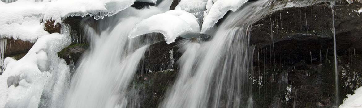
- Shypit Waterfall
- snack break
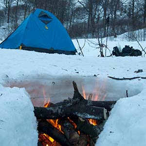
- hike to the camp site
- tent camp set up
- campfire dinner
- night stay in tent
day 2
- breakfast
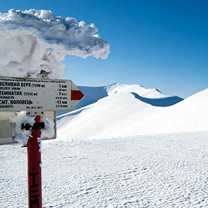
- ascent to Borzhava mountain range
- hike to Mount Vysokyi Verkh
- hike to the weather station at Mount Plai
- snack break
- descent to Volovets
- return to Lviv (appr. 22:00)
Price includes:
- bus (or minibus) transportation
- meals during the hike
- guiding services
Price does not include:
- equipment rent
- extra drinks and meals
- travel insurance
Special terms
The program of the tour is designed for physically healthy people who are interested in outdoor activities. The average distance of the daily hike is 6-10 km with the necessity to pave the trail in deep snow. Some parts of the trek may as well be firned that requires the usage of crampons further complicating the hike. This tour is of higher than moderate complexity. During the tour, everybody carries his/her own backpack with personal equipment and a share of food supply for the group.
Higher in the mountains, the temperature may be significantly lower than that at the foothills, and strong winds may occur. Unpredictable weather changes are possible, too.
The guide reserves the right to make changes in the program depending on the weather or the condition of the participants.
Recommended equipment
- Backpack for hiking (40-50L for women, 50-70L for men) with a rain cover
- Tent
- Sleeping pad
- Winter sleeping bag (comfort rating -5..-10 Cº)
- Waterproof trekking shoes and a spare pair
- Gaiters
- Warm socks (1 pair per day, 1 spare pair)
- Thermal underwear (both top and bottom)
- Wind stop and waterproof pants and a light jacket
- Warm jacket
- Fleece jackets or sweaters (1 light and 1 warm)
- Warm hat and buff
- 2 pairs of gloves, a light and a warm pair (waterproof and wind stop)
- Warm socks (1 pair per day, 1 spare pair)
- Polyurethane sitting mat with a fixing belt
- Thermos with hot tea
- Small plastic bottle of water
- Individual dinner set (spoon or spork, mug, pot, knife)
- Headlamp
- Cellphone
- Trekking poles
- Personal portable first-aid kit and toiletry
- Sunglasses or goggles
- Sunscreen
- Set of clothes for transfers during the tour (shoes, socks, underwear, outerwear): please mind that the clothes after hiking may be wet or dirty
Highlights
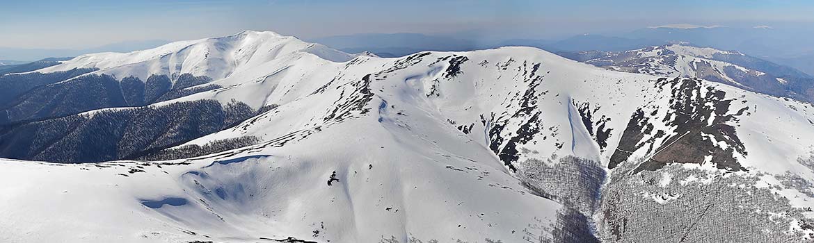
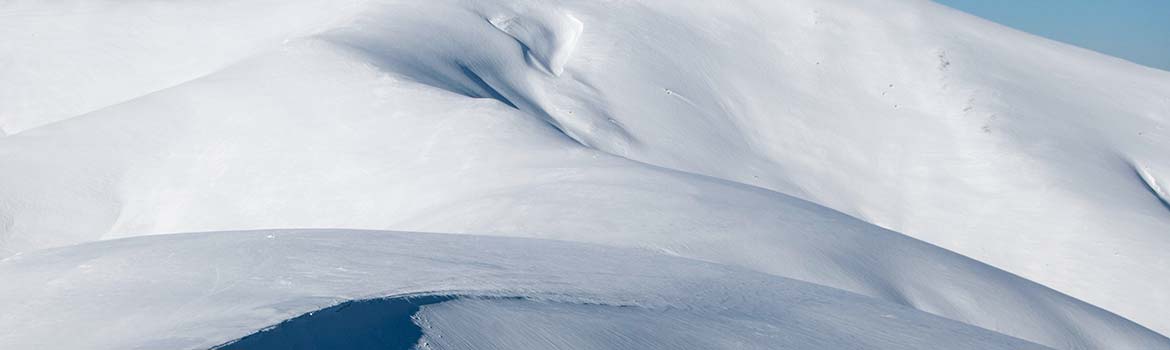
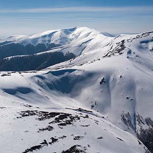 Polonyna Borzhava is a mountain range in the Ukrainian Carpathians, which lies between the rivers of Vicha, Borzhava, Ripynka and Rika in the Transcarpathian region. It has the longest woodless mountain meadows in Transcarpathia, stretching for about 50 km. Borzhava is mostly covered with grass and bilberry bushes, which creates the characteristic velvety appearance of its slopes and makes it a favourite destination for berry foraging from July till September.
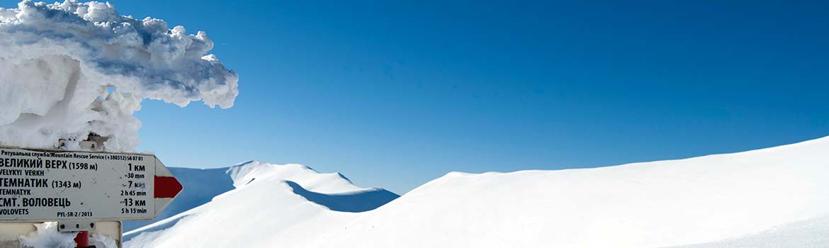
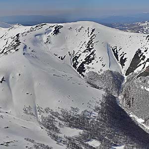 Velykyy Verkh (in Ukrainian, the Big Peak) is one of the mountains of the Borzhava Range (1598 m asl). The summit is a great viewpoint with the panorama of the whole range stretching from southeast to northwest in the form of a huge bow. Velykyy Verkh, together with a nearby Hymba Mountain, is the main destination for paragliders in the Carpathians.
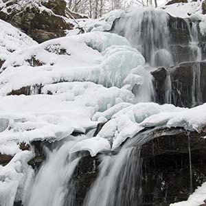 Shypit Waterfall is one of the most popular and attractive falls in the Ukrainian Carpathians, with its 5 cascades and the height of 14 m. It is an easy-accessible place, therefore it could be a crowded place during the high season. The place is also famous for the informal festival of alternative music, which takes place annually in the beginning of June.
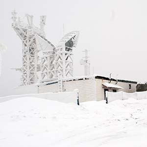 Play mountain is one of the peaks of the Borzhava Range (1330 m asl). On the summit, there is a television transmitter and a functioning meteorological station. The impressive panoramas of Temnatyk Mountain (1344 m asl) to the northwest and Velykyy Verkh Mountain (1598 m asl) to the southeast open from the summit.
Meals
2nd day: cooked campfire breakfast, snacks for lunch.
Rules
- No alcohol during the active walking part of the tour
- Please stick to the tour schedule and do keep up with the group
- Do not litter and take your waste with you
- Children under 16 should be accompanied by adults
Language
Ukrainian
Additional information:
- transfer from the railway station or airport
- booking accommodation in hotels
- guided tours
- advice regarding your stay and leisure time in Lviv — don’t hesitate to ask!
Відгуки:

Navigation
2026 © All Rights Reserved.